
Detached homes · At a glance
St. Andrews Heights: the starting evidence
- Median assessed value
- $1,130,0002026 City assessment roll · 402 matched records
- Median recorded lot area
- 639 m²Middle half: 585–696 m²
Assessments use a July 1, 2025 valuation date; they are not sold prices. See the source and calculation method.
Community facilities and an address-specific routine
The St. Andrews Heights Community Association publishes information about its hall, skating rink, tennis courts, playground and activities. Choose the facility or program that matters to your household and check current registration, booking or seasonal use directly. An association listing does not promise availability.
The association describes the area’s proximity to Foothills Hospital and the University of Calgary. If either destination matters to your move, test the actual journey from the home at the time you would travel. General proximity is not a verified commute or a guarantee of parking.
Site levels, room arrangement and planning
The City includes St. Andrews Heights in the South Shaganappi Communities Local Area Plan. Investigate current parcel information and nearby applications alongside the area policy. Land-use context does not itself confirm a specific addition, subdivision or redevelopment proposal.
At the home, record driveway approach, changes in grade, privacy and how living spaces connect to the yard. Compare measured above-grade area separately from basement development. For sellers, assemble renovation scope and condition records, then weigh those features against relevant completed detached sales and the houses competing for the same buyer.
Construction periods, neighbouring communities and park records
A closer look at St. Andrews Heights’s detached stock and setting
Choose the evidence the house needs
The largest recorded construction group is Before 1960: 218 of 402 valid-year records (54.2%). Start with this era when organizing your questions, then check the individual property’s records.
For an older original building, distinguish retained structure from later additions. Check documented foundation, roof, electrical and plumbing work, and measure above-grade space separately from developed basement space.
The mean assessment is 30.8% above the median. The middle half of recorded assessments runs from $981,750 to $1,870,000. This describes an unadjusted housing-stock distribution; it does not assign a location premium or value a candidate home. Recorded lots have a 638.7 m² median. Check usable dimensions, grading, easements and parking against the candidate property’s survey and documents.
Community edges to investigate
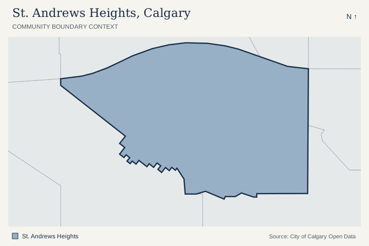
The City polygons share a boundary segment with Parkdale, University Heights, University of Calgary, West Hillhurst. Use the map to investigate a home near these edges; a shared polygon boundary does not establish a street connection, route or comparable-home relationship.
Named City park-site records
3 active named park-site polygons overlap the St. Andrews Heights outline by at least 100 m². The names below are City dataset labels, which can include school grounds and shared facilities.
Review the named site records
- MARIA MONTTESSORI SCHOOL; FORMER CHIEF CROWFOOT SCHOOL · subneighbourhood park · City site STA539
- ST ANDREWS HEIGHTS ESCARPMENT · district park · City site STA506
- ST ANDREWS HTS COMMUNITY · community park · City site STA544
A polygon overlap is location evidence. It does not establish a public entrance, opening hours, admission, school designation or access rights. Check the site and its operator before planning an outing. City park visitor information.
Location join checked October 8, 2026. City Parks Sites and City community boundaries. Active named park sites exclude non-park and depot categories. Shared boundaries require at least 25 metres of exact boundary; this list is not exhaustive where polygons have gaps. Areas and lengths use NAD83 / UTM zone 11N. All house figures above use the separate detached-only assessment extract.
St. Andrews Heights: detached assessment context
2026 City assessment-roll extract, checked October 8, 2026. The valuation date is July 1, 2025, with property condition recorded as of December 31, 2025. These figures describe matching detached assessment records. They are not sold prices, current inventory or a valuation of your home.
| Measure | Recorded context |
|---|---|
| Matched assessment records | 402 |
| Median assessed value | $1,130,000 |
| Middle 50% of assessed values | $981,750–$1,870,000 |
| Mean assessed value | $1,478,300 |
| Recorded assessed-value range | $681,500–$4,700,000 |
| Median recorded land area | 639 m² |
| Middle 50% of recorded land areas | 585–696 m² |
| Mean recorded land area | 651 m² |
| Recorded construction-year span | 1952–2025 |
| Coverage | 25 or more matching records |
Construction periods and calculation method
| Period | Records with a known construction year |
|---|---|
| Before 1960 | 218 (54.2%) |
| 1960–1989 | 67 (16.7%) |
| 1990–2009 | 33 (8.2%) |
| 2010–2019 | 64 (15.9%) |
| 2020–2026 | 20 (5.0%) |
The construction breakdown uses 402 records with valid recorded years. Land distributions use 402 positive recorded areas. The median is the midpoint; the middle 50% runs from the 25th to 75th percentile, using linear interpolation. It is not a confidence interval or a listing-price range.
Filter: 2026 roll, residential class RE, land-and-improvement type LI, sub-property uses R110 and R111 (detached and detached with backyard suite), positive assessed values. Counts are matched records, not an independently deduplicated house count. Other housing classifications and vacant-land types are excluded. Assessments can reflect a property’s stage of completion; especially in developing areas, verify completion and current property records before comparing values.
City of Calgary assessment source. The mean is sensitive to unusual properties. Use relevant completed detached sales and current competing detached listings for a property-specific value review. Read the full detached assessment analysis and methodology.
Plan a local visit
Plan your St. Andrews Heights visit
Use these separate stops to investigate your own routine. Choose your transport and check current operator details before visiting.
- Choose an association activity and confirm current arrangements.
- Test the actual journey to the destination relevant to your routine.
- Compare driveway approach, grade and yard use at the house.
- Review parcel information and available renovation records.
Compare the St. Andrews Heights home, then its competition
- How do lot levels and the driveway work for everyday use?
- Which improvements have supporting records?
- Which detached alternatives provide the closest layout and site comparison?
Use these questions alongside current Calgary homes for sale; confirm which listings match your area and property requirements.
For nearby development applications and address-specific planning information, use the official Calgary development research tools.
For a St. Andrews Heights detached sale, explain the specific site, usable layout and documented improvements alongside relevant detached alternatives. Review the detached houses competing for your buyer.
Questions about St. Andrews Heights
Where can I check St. Andrews Heights recreation?
The community association publishes its facilities and activities. Confirm current registration, booking and seasonal availability directly.
Which area plan includes St. Andrews Heights?
The City includes it in the South Shaganappi Communities Local Area Plan. Check the particular parcel separately before relying on intended changes.
Official sources and local resources
An original area-planning guide with links to the relevant City, school, association and operator resources. Local collection checked . The City profile is a 2021 Census resource. Confirm current hours, programs and access with the linked source; school designation depends on address and program.
- CommunityCity community profile (opens in a new tab)2021 Census
Official demographic and household context from the 2021 Census.
- Community associationSt. Andrews Heights Community Association (opens in a new tab)Local facilities & activities
Association information on facilities, programs and participation.
- PlanningSouth Shaganappi plan (opens in a new tab)Includes St. Andrews Heights
Official City area policy; investigate the actual parcel separately.
- SchoolsCheck designated schools (opens in a new tab)Address and program
Use your home address and chosen program to confirm public school designation.