
Detached homes · At a glance
Mahogany: the starting evidence
- Median assessed value
- $848,0002026 City assessment roll · 4,493 matched records
- Median recorded lot area
- 382 m²Middle half: 314–440 m²
- South East district detached benchmark
- $698,900September 2026 · Entire district, all detached price ranges
Assessments use a July 1, 2025 valuation date; they are not sold prices. The district benchmark describes a broader market, not this neighbourhood alone. See the source and calculation method.
Urban Village and wetlands: plan a public-facing visit
The developer’s Urban Village guide provides a starting point for Village Market, Village Commons and Westman Village. Choose the shops or services relevant to your routine, then verify current operator details. Treat the area visit as research into your own preferences rather than evidence of a home’s market value.
The Mahogany HOA’s local amenities page describes the City-owned wetlands pathways separately from the controlled-access lake amenities. Use the current resource to plan the kind of visit you want. Check the actual path access and route from a candidate address.
Lake and Beach Club: review membership separately
Mahogany’s HOA publishes documentation and access requirements for the lake and Beach Club. Review those requirements directly when considering a property. A community name or a nearby address is not a substitute for confirming the membership arrangements relevant to the home.
For the property comparison, record the layout, lot setting, condition and the obligations you would take on. Ask which applicable documents and amounts need confirmation. Keep the public pathway visit, lake access requirements and home condition as separate entries in your decision notes.
Construction periods, neighbouring communities and park records
A closer look at Mahogany’s detached stock and setting
Choose the evidence the house needs
The largest recorded construction group is 2010–2019: 2,866 of 4,488 valid-year records (63.9%). Start with this era when organizing your questions, then check the individual property’s records.
Check completion documents, subsequent alterations and maintenance records. Compare usable main-floor space, storage and yard dimensions rather than assuming houses from the same period have the same condition or layout.
The mean assessment is 6.6% above the median. The middle half of recorded assessments runs from $734,000 to $958,000. This describes an unadjusted housing-stock distribution; it does not assign a location premium or value a candidate home. Recorded lots have a 382.4 m² median. Check usable dimensions, grading, easements and parking against the candidate property’s survey and documents.
Community edges to investigate
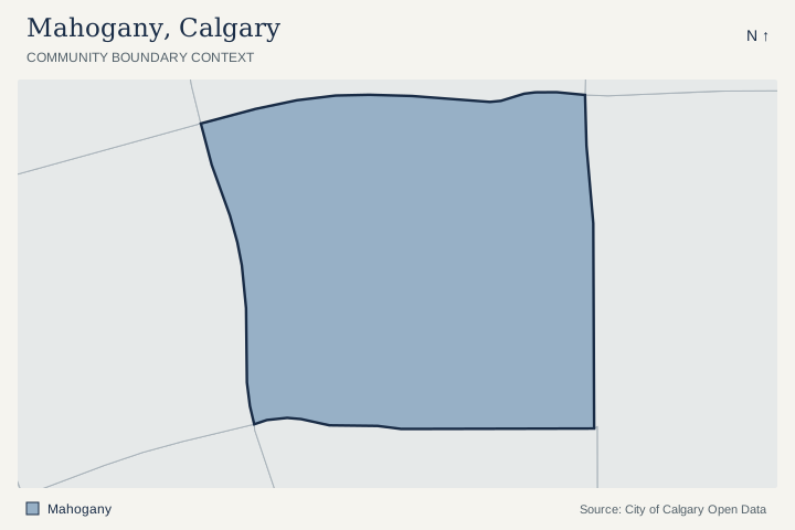
The City polygons share a boundary segment with 12j, Auburn Bay, Copperfield, Rangeview. Use the map to investigate a home near these edges; a shared polygon boundary does not establish a street connection, route or comparable-home relationship.
Named City park-site records
4 active named park-site polygons overlap the Mahogany outline by at least 100 m². The names below are City dataset labels, which can include school grounds and shared facilities.
Review the named site records
- DIVINE MERCY ELEM · community park · City site MAH002
- MAHOGANY ELEM SCHOOL · neighbourhood park · City site MAH001
- MAHOGANY GREENWAY · regional park · City site MAH465
- MAHOGANY WETLANDS · district park · City site MAH050
A polygon overlap is location evidence. It does not establish a public entrance, opening hours, admission, school designation or access rights. Check the site and its operator before planning an outing. City park visitor information.
Location join checked October 8, 2026. City Parks Sites and City community boundaries. Active named park sites exclude non-park and depot categories. Shared boundaries require at least 25 metres of exact boundary; this list is not exhaustive where polygons have gaps. Areas and lengths use NAD83 / UTM zone 11N. All house figures above use the separate detached-only assessment extract.
Mahogany: detached assessment context
2026 City assessment-roll extract, checked October 8, 2026. The valuation date is July 1, 2025, with property condition recorded as of December 31, 2025. These figures describe matching detached assessment records. They are not sold prices, current inventory or a valuation of your home.
| Measure | Recorded context |
|---|---|
| Matched assessment records | 4,493 |
| Median assessed value | $848,000 |
| Middle 50% of assessed values | $734,000–$958,000 |
| Mean assessed value | $904,018 |
| Recorded assessed-value range | $177,500–$3,580,000 |
| Median recorded land area | 382 m² |
| Middle 50% of recorded land areas | 314–440 m² |
| Mean recorded land area | 401 m² |
| Recorded construction-year span | 2008–2025 |
| Coverage | 25 or more matching records |
Construction periods and calculation method
| Period | Records with a known construction year |
|---|---|
| Before 1960 | 0 (0.0%) |
| 1960–1989 | 0 (0.0%) |
| 1990–2009 | 148 (3.3%) |
| 2010–2019 | 2,866 (63.9%) |
| 2020–2026 | 1,474 (32.8%) |
The construction breakdown uses 4,488 records with valid recorded years. Land distributions use 4,493 positive recorded areas. The median is the midpoint; the middle 50% runs from the 25th to 75th percentile, using linear interpolation. It is not a confidence interval or a listing-price range.
Filter: 2026 roll, residential class RE, land-and-improvement type LI, sub-property uses R110 and R111 (detached and detached with backyard suite), positive assessed values. Counts are matched records, not an independently deduplicated house count. Other housing classifications and vacant-land types are excluded. Assessments can reflect a property’s stage of completion; especially in developing areas, verify completion and current property records before comparing values.
City of Calgary assessment source. The mean is sensitive to unusual properties. Use relevant completed detached sales and current competing detached listings for a property-specific value review. Read the full detached assessment analysis and methodology.
September 2026 · CREB district-level data
Detached market context for the South East district
CREB® reports a $698,900 detached benchmark (−1.55% year over year) and 3.34 months of supply for the South East district. Mahogany is within that district, but these figures cover all its detached price ranges. They are district-level data, not Mahogany-specific statistics or a valuation of your home.
For a Mahogany sale, verify property-specific lake obligations and compare the actual layout, condition and remaining work. The broader South East change does not quantify the value of an individual lake-community home.
Use the interactive South East district comparison and the September 2026 seller brief, then apply the pricing evidence framework to relevant homes.
Source: CREB® September 2026 Monthly Statistics Package. Page 7, detached district table; page 29, district map. Property interpretation by Alex Pidann, independently of CREB®.
Plan a local visit
Plan your Mahogany visit
Use these separate stops to investigate your own routine. Choose your transport and check current operator details before visiting.
- Choose an Urban Village stop that reflects a regular errand.
- Use the HOA local amenities page to plan a wetlands-pathway visit.
- Keep the proposed visit separate from membership-controlled lake and Beach Club entry.
- When a property is shortlisted, confirm its membership arrangements and relevant obligations directly.
Compare the Mahogany home, then its competition
- Which membership rights and obligations would attach to this specific property?
- How does the actual route to a public pathway or daily service work for you?
- How do lot setting, layout and remaining work compare with the alternative homes?
Use these questions alongside current Calgary homes for sale; confirm which listings match your area and property requirements.
For nearby development applications and address-specific planning information, use the official Calgary development research tools.
For a Mahogany sale, confirm property-specific lake obligations and explain the actual layout and condition alongside the surrounding amenities. Review the property evidence before deciding on a price.
Questions about Mahogany
Are the wetlands pathways the same as the lake and Beach Club?
The HOA describes the City-owned wetlands pathways separately from the lake amenities. Lake and Beach Club access have their own membership documentation and requirements.
Can I assume lake access from a Mahogany address?
Verify the arrangements relevant to the specific property using the HOA’s current documentation. Confirm any required records and applicable obligations before relying on lake access in your purchase decision.
Official sources and local resources
An original area-planning guide with links to the relevant City, school, association and operator resources. The City profile is a 2021 Census resource. Confirm current hours, programs and access with the linked source; school designation depends on address and program.
- CommunityCity community profile (opens in a new tab)2021 Census
Official demographic and household context from the 2021 Census.
- Shops & diningMahogany Urban Village (opens in a new tab)In this community
The developer’s guide to Village Market, Village Commons and Westman Village.
- Parks & pathsMahogany Wetlands and pathways (opens in a new tab)In this community · City-owned paths
HOA information on wetlands pathways, separately from the controlled-access lake amenities.
- Lake membershipMahogany lake access (opens in a new tab)Membership access
Check the HOA’s documentation and access requirements for the lake and Beach Club.
- SchoolsCheck designated schools (opens in a new tab)Address and program
Use your home address and chosen program to confirm public school designation.